The Pippa Middleton planning dispute concerns a legal challenge over whether Mill Lane on the Barton Court estate in Berkshire should be recognised as a public right of way or remain private.
West Berkshire Council ruled in favour of public access following evidence from local residents and the Ramblers, but Pippa Middleton and James Matthews are contesting that decision, citing privacy, security, and legal grounds.
A public inquiry will determine the outcome based on historical use and UK planning law.
Key takeaways:
- Dispute centres on Mill Lane’s status as a public footpath
- Council supports public right of way designation
- Estate argues the route has always been private
- Residents claim decades of uninterrupted use
- Planning Inspectorate will decide the final outcome
- Case highlights UK legal tensions between access and ownership
What Is the Pippa Middleton Planning Dispute About?
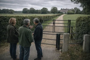
The Pippa Middleton planning dispute centres on a disagreement over land use at the Barton Court estate in Berkshire, owned by Pippa Middleton and her husband, James Matthews.
The issue focuses on Mill Lane, a route that crosses part of the estate and has become the subject of legal scrutiny regarding its status.
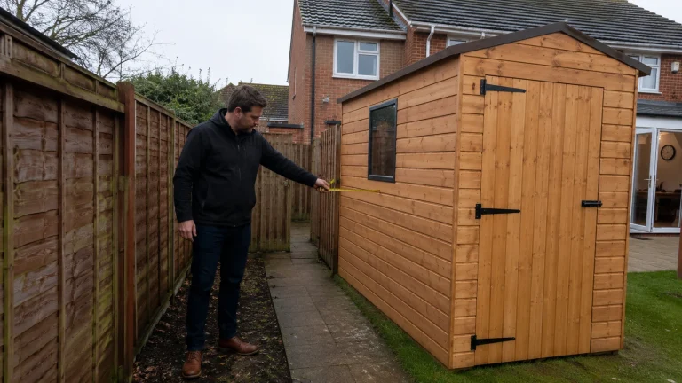
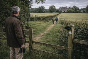
Following the purchase of the estate in 2022, changes were made to restrict access to the lane. Gates, railings, and signage were installed, effectively preventing members of the public from using the route.
These actions prompted objections from local residents and organisations who believed the lane had long functioned as a public footpath.
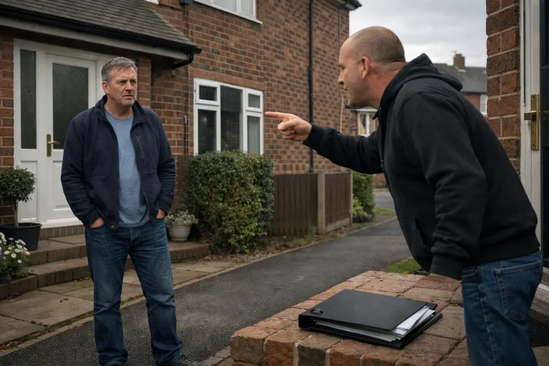
The situation escalated when West Berkshire Council reviewed an application and determined that the lane should be recognised as a public right of way. This decision has been challenged by the estate, leading to a formal legal process that will involve a public inquiry.
The dispute reflects a broader issue within UK property law where private ownership intersects with historical public usage. Cases like this often depend on detailed evidence and legal interpretation rather than straightforward ownership rights.
Why Is Mill Lane Considered a Public Right of Way?
Mill Lane is considered by many locals to be a public right of way due to its longstanding use by the community. The application submitted by the West Berkshire Ramblers played a key role in bringing this issue to the attention of the local authority.
The council’s decision was not based on ownership alone but on whether the route had been used openly and continuously by the public over a significant period.
What Evidence Have Local Residents Provided?
Residents of Kintbury have contributed detailed accounts describing how the lane has been used over several decades. These statements form a central part of the case supporting public access.
Key themes from the evidence include:
- Regular use of the lane for walking and connecting different parts of the village
- Absence of visible restrictions such as gates or warning signs prior to 2022
- The perception that the route was part of an established footpath network
Many residents described the route as logical and accessible, reinforcing the belief that it was intended for public use. Some testimonies also highlight that the lane provided a safer alternative to nearby roads.
The table below summarises the types of evidence considered in such cases:
| Evidence Type | Description | Relevance in Dispute |
| Witness statements | Accounts from local residents | Demonstrates historical use |
| Historical maps | Old maps showing pathways | Supports continuity of access |
| Photographic records | Images of the route over time | Shows lack of restrictions |
| Council records | Official documentation | Confirms legal considerations |
This combination of evidence is critical in determining whether a path qualifies as a public right of way under UK law.
Why Did Pippa Middleton and James Matthews Close the Footpath?
The closure of Mill Lane followed the acquisition of Barton Court estate by James Matthews. As part of estate management, steps were taken to secure the property and limit access.
The installation of an electric gate in October 2022 marked a significant change. Signage indicating restricted access reinforced the position that the route was private.
From the estate’s perspective, these actions were necessary for several reasons:
- Maintaining privacy for residents and visitors
- Ensuring security across the estate
- Clarifying boundaries of private property
The estate has maintained that the lane was never intended to be a public footpath and that its use by locals does not meet the legal criteria required for such designation.
The table below outlines the estate’s key actions and their intended purpose:
| Action Taken | Purpose | Outcome |
| Installation of electric gate | Restrict access | Prevented public entry |
| Placement of signage | Communicate private status | Reinforced ownership claim |
| Legal objection | Challenge council decision | Initiated formal dispute |
These measures reflect a common approach taken by landowners seeking to assert control over their property.
What Are the Legal Arguments in the Planning Dispute?

The legal arguments in the Pippa Middleton planning dispute revolve around whether Mill Lane meets the statutory requirements to be classified as a public right of way. This involves interpreting evidence related to long-term use and the intentions of the landowner.
The estate argues that the route does not meet the legal threshold and has always been private. They also point to signage and historical management of the land as evidence that access was not permitted.
What Does UK Planning Law Say About Public Footpaths?
UK law sets out specific conditions under which a path can be recognised as a public right of way. These include continuous and uninterrupted use by the public over a period of at least 20 years, without explicit permission or objection from the landowner.
A planning consultant explained the situation clearly: “In disputes like this, the burden of proof often lies in demonstrating uninterrupted public use. If the landowner can show consistent efforts to restrict access, it weakens the claim for a public right of way.”
This highlights the importance of both historical evidence and documented actions by the landowner.
The legal framework is summarised in the table below:
| Legal Requirement | Explanation | Application in Case |
| Continuous use | Public use over 20 years | Claimed by residents |
| Lack of permission | Use without explicit consent | Disputed by estate |
| Landowner challenge | Evidence of restriction | Central to defence |
| Definitive map order | Legal recognition process | Used by council |
The outcome will depend on how these elements are interpreted by the Planning Inspectorate.
How Are Local Residents Affected by the Footpath Closure?
The closure of Mill Lane has had practical and social implications for residents of Kintbury. The route was seen as a convenient and safe way to navigate the village, particularly for pedestrians.
Without access to the lane, residents may need to rely on alternative routes that are less suitable for walking. Concerns have been raised about safety, especially on roads with limited pedestrian infrastructure.
A resident described the impact clearly: “We used that path for years without any issue. It was the safest way to get across the village, and now people are forced onto roads that were never designed for foot traffic.”
The effects of the closure can be summarised as follows:
- Reduced accessibility within the village
- Increased reliance on potentially hazardous roads
- Loss of a valued local amenity
The table below compares the two route options:
| Route Option | Safety Level | Accessibility | Public Preference |
| Mill Lane | High | Direct and convenient | Strongly preferred |
| Alternative road | Lower | Less direct | Less favourable |
This comparison illustrates why the dispute has generated strong local interest.
What Is the Role of the Planning Inspectorate in This Case?
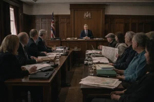
The Planning Inspectorate is responsible for conducting an independent review of the dispute. A public inquiry will allow both sides to present evidence and arguments.
The process involves several stages, including submission of documents, witness testimonies, and legal analysis. The inspector will then make a determination based on the available evidence.
Key aspects of the inquiry include:
- Examination of historical usage
- Review of legal documentation
- Consideration of community impact
The table below outlines the inquiry process:
| Stage | Description | Purpose |
| Evidence submission | تقديم documents and statements | Establish facts |
| Public hearing | Presentation of arguments | Ensure transparency |
| Inspector review | Analysis of evidence | Form decision |
| Final ruling | Official outcome | Resolve dispute |
This structured approach ensures that all perspectives are considered before a final decision is made.
What Could Be the Outcome of the Planning Dispute?
The outcome of the dispute remains uncertain and will depend on the findings of the public inquiry. Several scenarios are possible, each with different implications.
A property law expert provided insight into potential outcomes: “These cases rarely produce a clear winner in the traditional sense. The decision often reflects a balance between legal principles and practical realities on the ground.”
Possible outcomes include recognition of the lane as a public footpath, rejection of the claim, or a requirement for further evidence.
The table below outlines these possibilities:
| Outcome | Description | Implications |
| Public right of way confirmed | Lane remains accessible | Limits estate control |
| Claim rejected | Lane stays private | Supports landowner rights |
| Further investigation | Additional review needed | Delays resolution |
| Compromise solution | Partial access granted | Balances interests |
Each scenario highlights the complexity of resolving such disputes.
How Do UK Planning Disputes Over Footpaths Typically Get Resolved?
Planning disputes involving footpaths often follow a structured legal process but can vary depending on the specifics of each case. Evidence plays a central role, particularly when it comes to historical usage.
Resolution methods may include:
- Formal inquiries conducted by the Planning Inspectorate
- Legal appeals through the courts
- Negotiated agreements between parties
A legal advisor summarised the process: “What makes these disputes challenging is that they rely heavily on historical behaviour rather than clear documentation. Each piece of evidence contributes to a broader picture.”
The table below provides an overview of resolution methods:
| Method | Description | Typical Outcome |
| Public inquiry | Independent review | Binding decision |
| Court appeal | Legal challenge | Possible reversal |
| Negotiation | Agreement between parties | Compromise solution |
These mechanisms ensure that disputes are handled within a clear legal framework.
What Does This Case Mean for Property Owners and Public Access in the UK?
The Pippa Middleton planning dispute highlights important considerations for both landowners and the public. For property owners, it underscores the need to clearly define and manage access to their land.
For the public, it demonstrates the importance of documenting and protecting traditional routes.
The case may influence how similar disputes are approached in the future, particularly in rural areas where informal paths are common and often relied upon by local communities.
Understanding the balance between private rights and public access remains a key issue in UK planning law, and this dispute serves as a significant example of how that balance is tested.
Conclusion
The Pippa Middleton planning dispute offers a detailed example of how property law, public rights, and local interests can intersect. At its core, the case raises important questions about land use, access, and legal interpretation.
As the inquiry approaches, the outcome will be closely watched, not just for its immediate impact but for its broader significance in shaping UK planning law and countryside access rights.
FAQs
What is a public right of way in the UK?
A public right of way is a path that the public has a legal right to use, even if it crosses private land, provided certain conditions are met.
How is a footpath officially recognised?
It is typically added through a definitive map modification order based on evidence of long-term public use.
Can landowners block public footpaths?
Landowners cannot block legally recognised public rights of way, but they can challenge claims before they are officially established.
What is a planning inspectorate inquiry?
It is a formal review process where an independent inspector examines disputes related to planning and land use.
How long does a planning dispute take to resolve?
It can take several months or even years, depending on the complexity and evidence involved.
What happens if the council’s decision is overturned?
If overturned, the route will not be recognised as a public right of way, and access can be restricted.
Why are footpath disputes common in rural areas?
They often arise due to unclear historical records and long-standing informal use of land by the public.